💻 For the best experience, view this site on desktop
Power Utility Solutions
Aerial intelligence for transmission and distribution infrastructure management
The Challenge
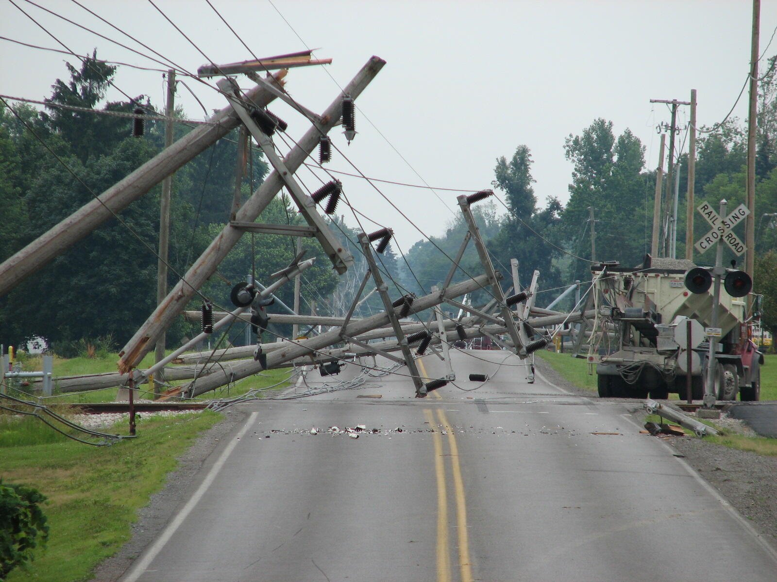
Power utilities manage thousands of miles of transmission and distribution infrastructure across diverse and often inaccessible terrain. Traditional inspection methods are time-consuming, expensive, and expose personnel to hazardous conditions.
Critical infrastructure failures, vegetation encroachment, and storm damage require rapid response to prevent outages, reduce wildfire risk, and maintain regulatory compliance.
The Solution
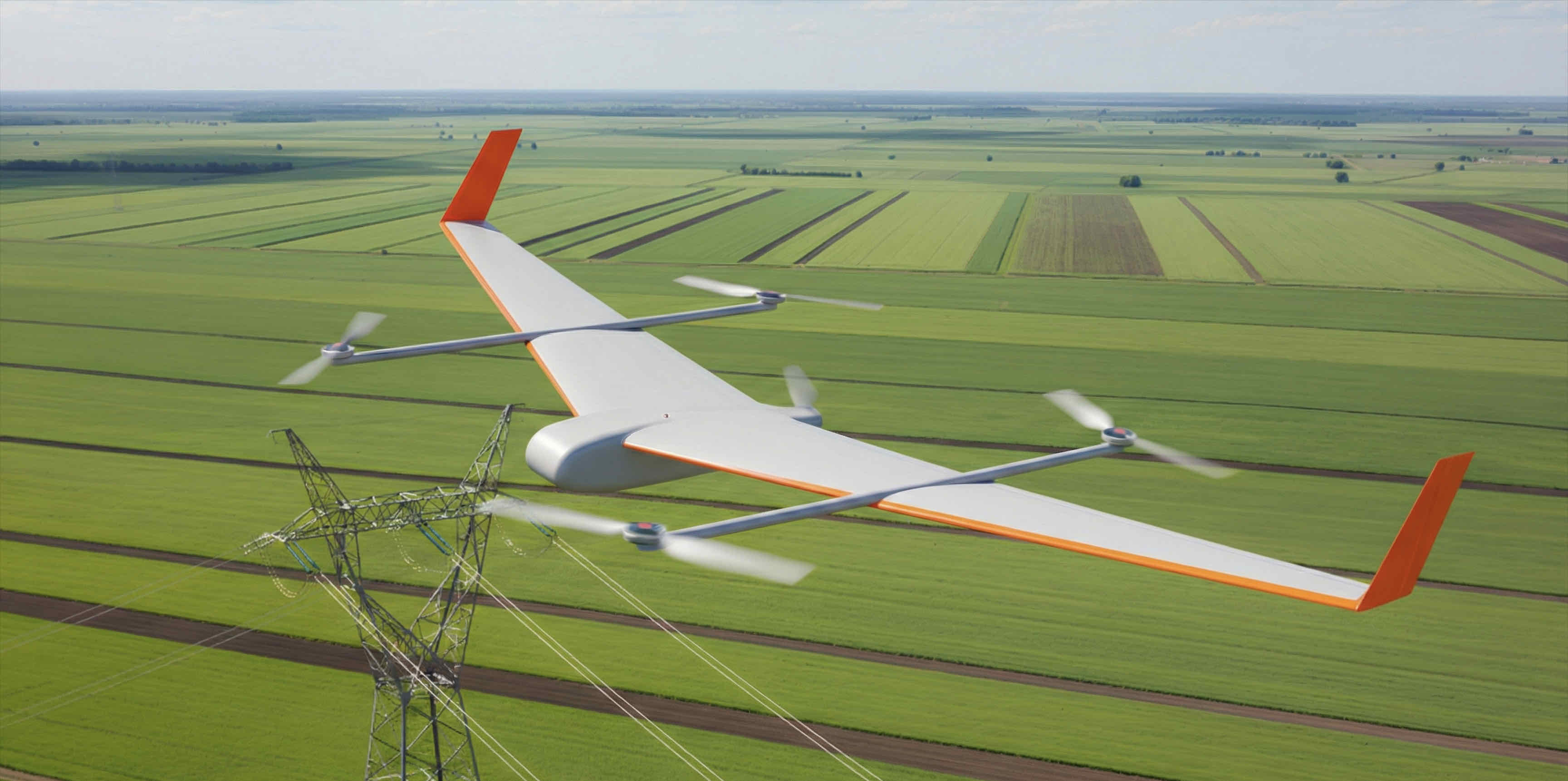
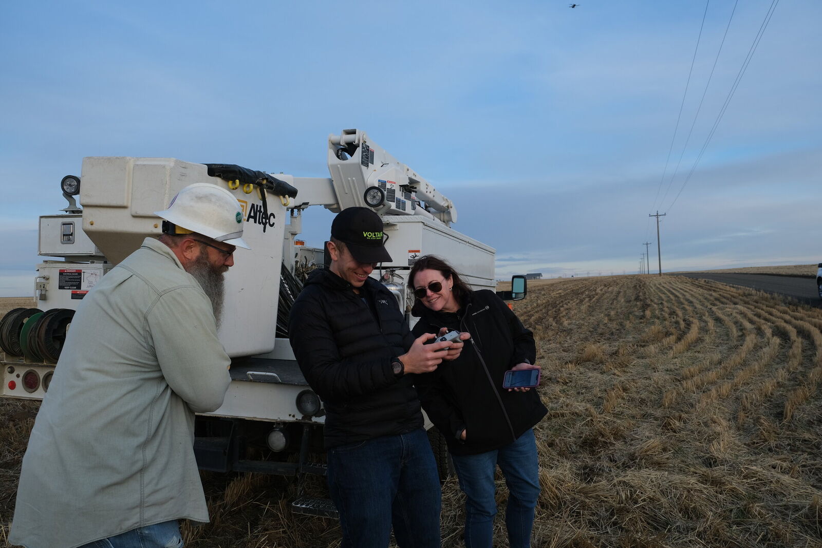
Voltair delivers on-demand aerial imagery as a service, enabled by ultra-weatherized, long-range drones that recharge in the field on inductive charging pads. Charging remotely enables Voltair to deploy drones without the need for truck rolls or battery swaps.
Our autonomous flight systems, high-resolution sensors, and AI-powered analytics deliver actionable intelligence for both reactive response and proactive maintenance programs.
Key Benefits
Access Hard to Reach Places
Without the constraints of trucks, long-range drones can efficiently collect data on the most remote locations in your service area.
Real Time Data
Crews can review inspection data in real time, allowing operators to re-inspect and improve data quality on demand.
Safety
Remotely operated drones protect linemen from live voltage and replace the need for dangerous helicopter operations.
Faster Response
With 80mph max speed, we can reach any single point in your entire service area in 5 minutes or less, given sufficient pad coverage.
Use Cases
Virtual Truck Roll
With 80mph max speed, we can reach any single point in your entire service area in 5 minutes or less, given sufficient pad coverage.
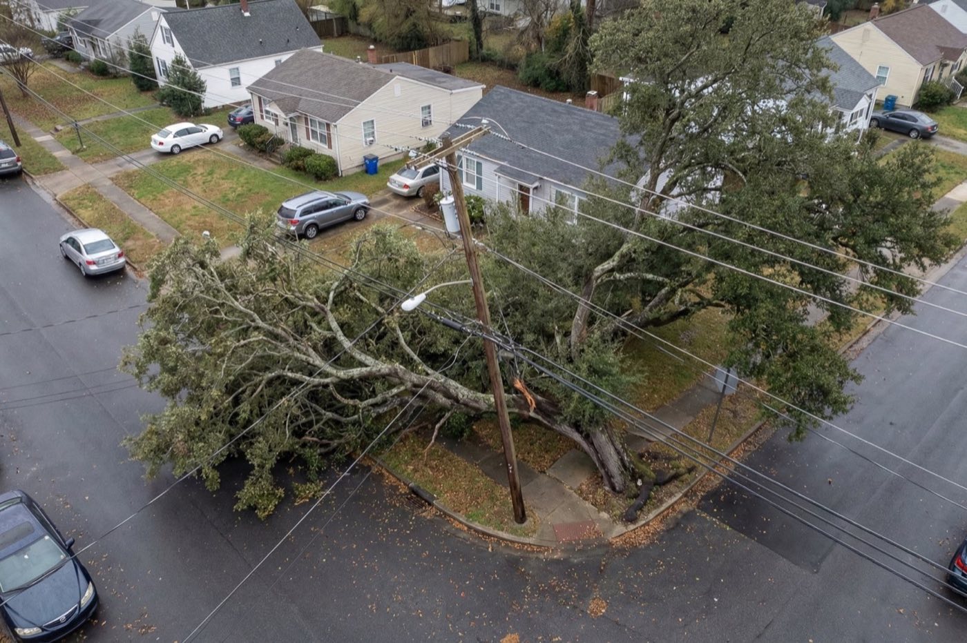
Storm Response
Ahead of adverse weather, drones can be pre-positioned in optimal locations. We can assess damage faster than any truck, helicopter, or manual drone operator.
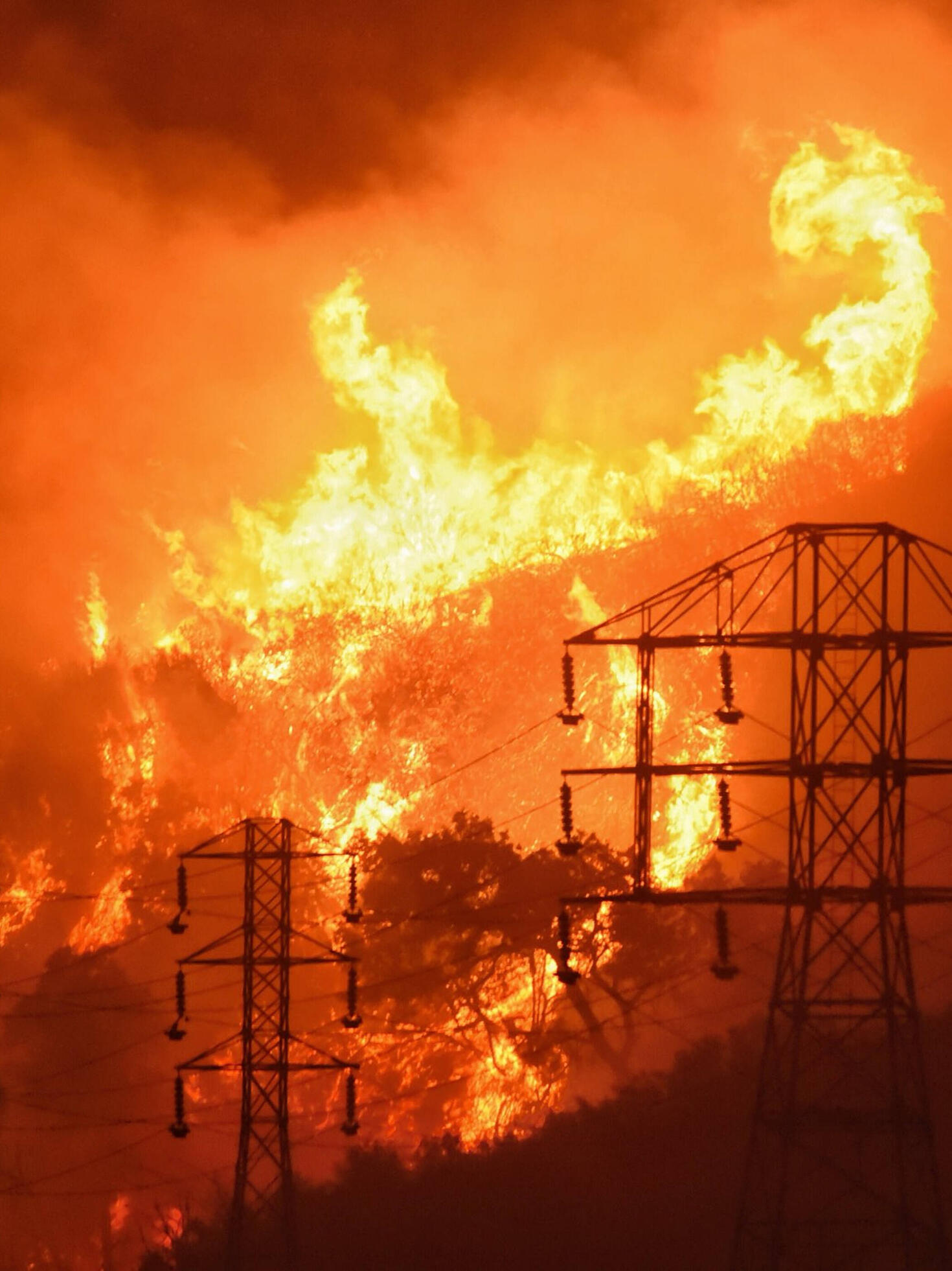
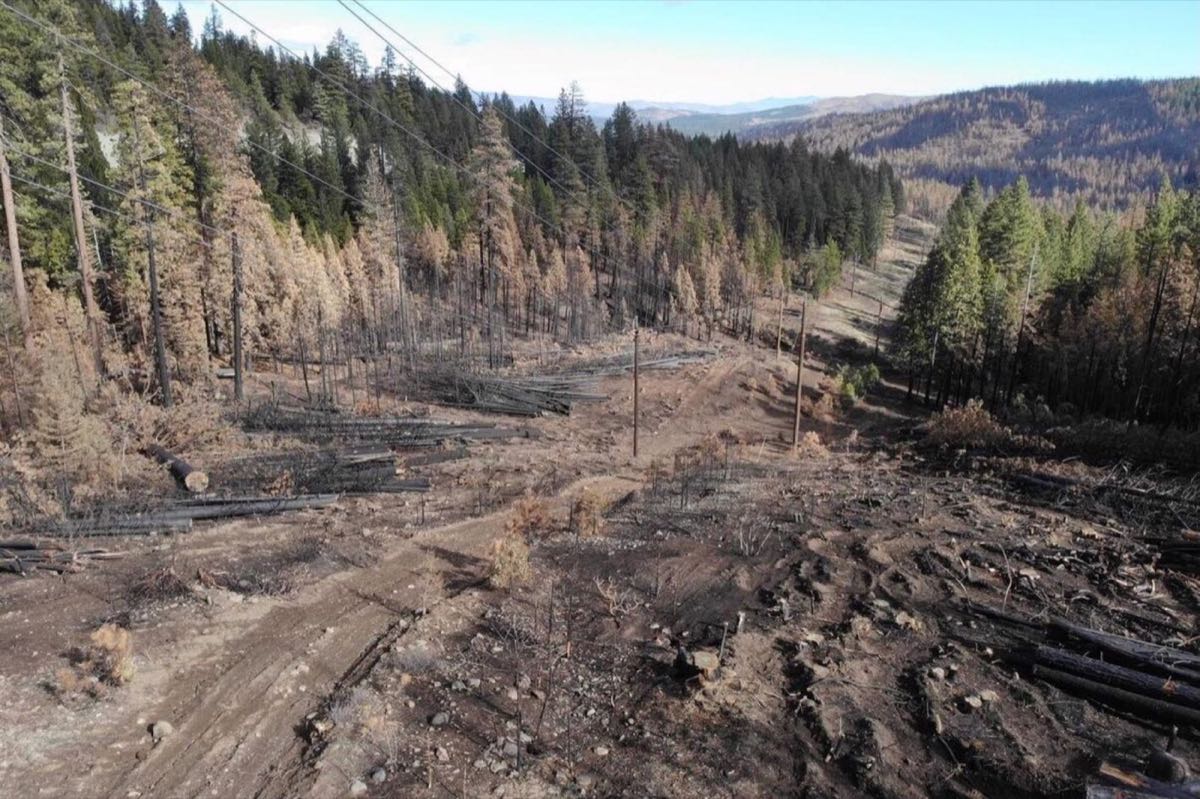
Active Wildfire Monitoring
Monitor wildfire movement towards lines in real-time, providing immediate alerts and continuous perimeter tracking to protect infrastructure.
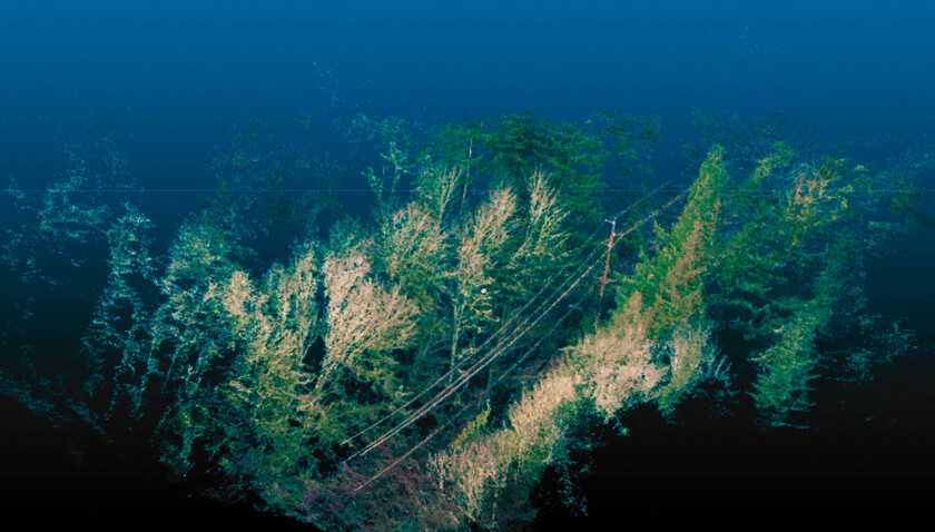
Vegetation Management
Detect growth rates and encroachments into Right-of-Way before NERC FAC-003 violations occur. High-resolution imagery tracks tree health metrics and identifies hazard trees before failure.
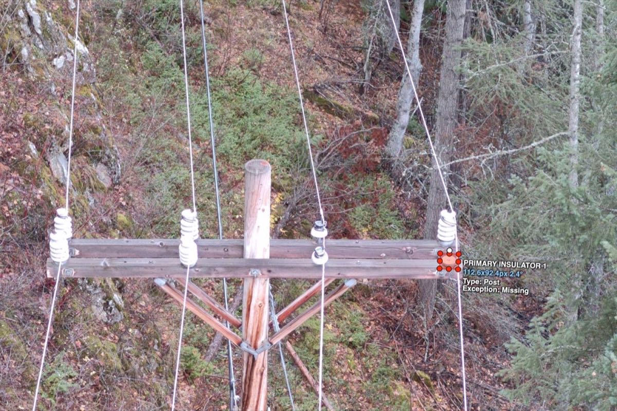
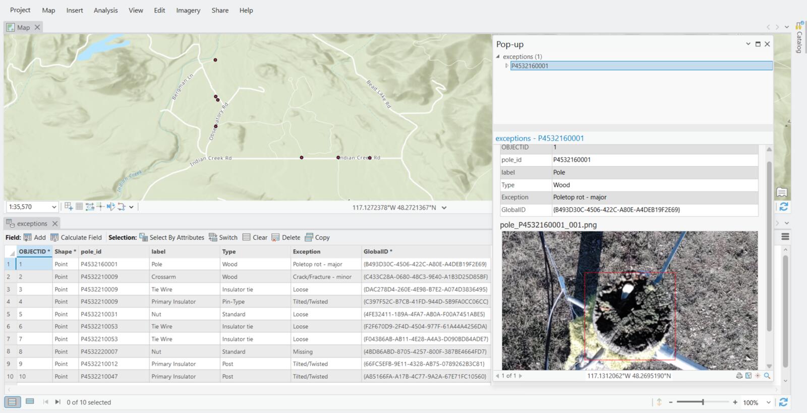
Asset Inspections
Recurring detailed asset inspections identify and predict maintenance exceptions, enabling predictive maintenance programs that reduce unplanned outages and corrective maintenance costs.
Engineering Digital Twin
Always up-to-date 3D models and infrastructure maps for engineering validation and compliance.
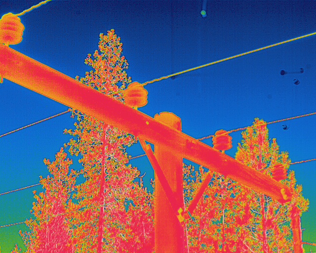
Thermal Hotspot Detection
Regular thermal imaging surveys identify overheating components, loose connections, and equipment degradation before catastrophic failure occurs.